GPX Mapper
Create maps of your activities with self-calculated stats from GPX files. Upload multiple tracks to get heatmaps or multi-stage route visualizations.
Tech Stack
Python for the backend parsing and stats calculation. MapLibre GL for the open-source map rendering.
I started working on GPX Mapper because I got into cycling and was frustrated with how difficult it was to visualize my GPS tracks the way I wanted.
The first prototype
My first attempt was super basic. I threw together a quick app where you could upload GPX files and it would plot them onto a map. Rough — no fancy design, no customization, just a plain display of my activities.
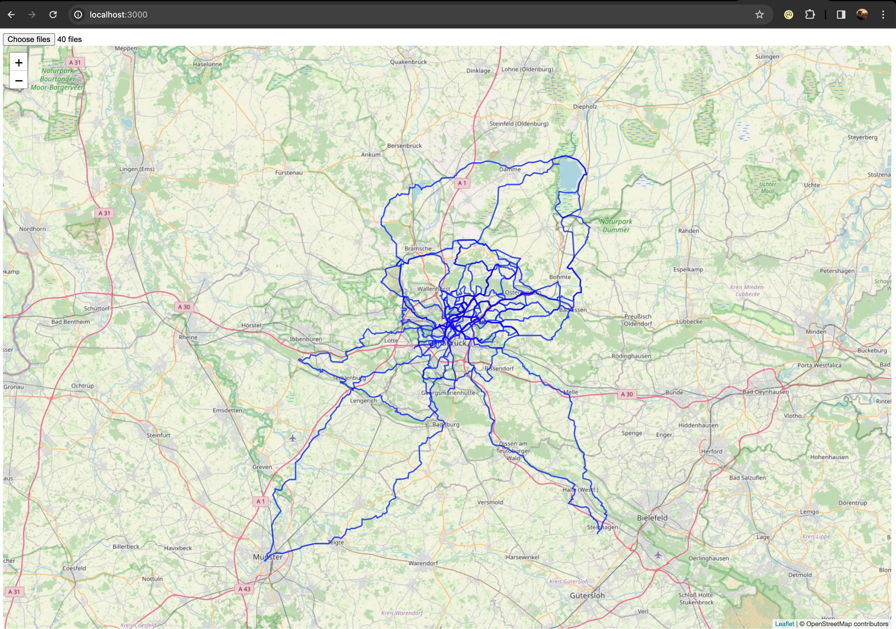
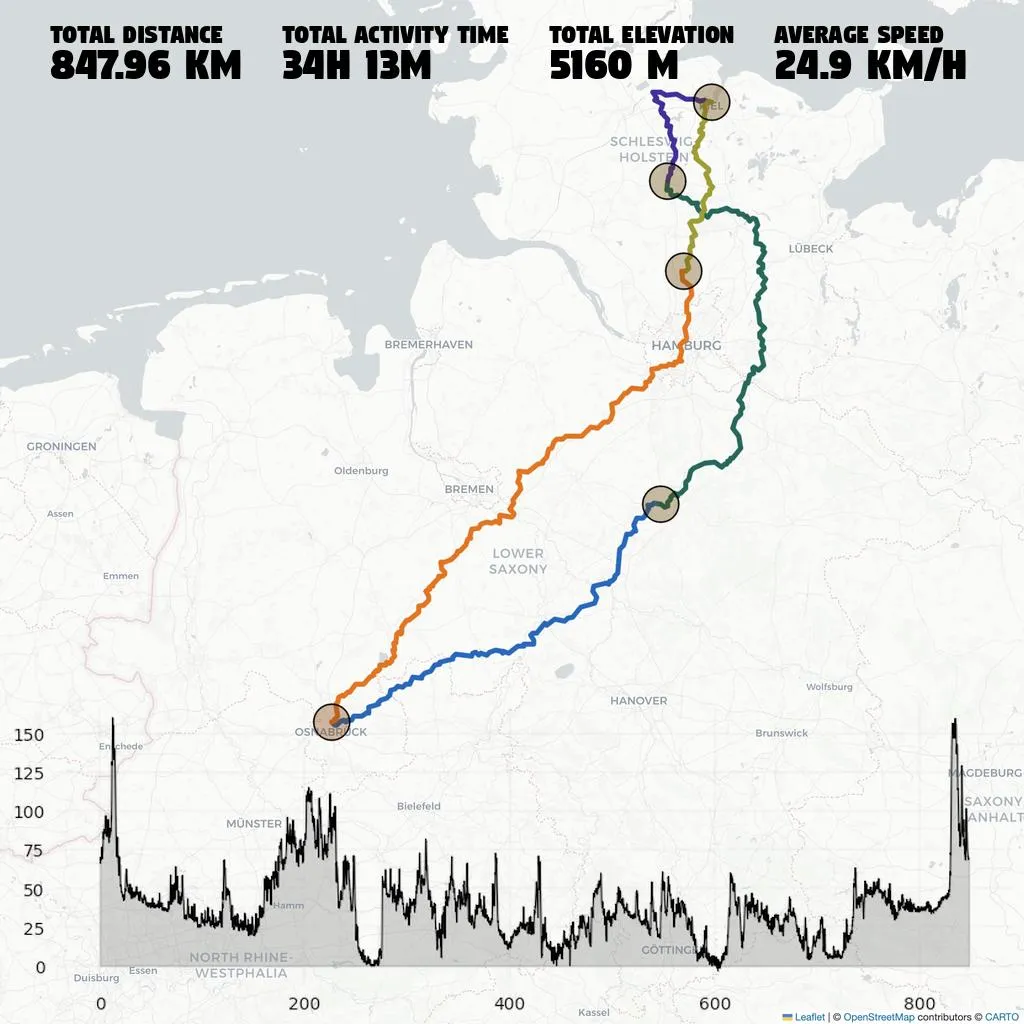
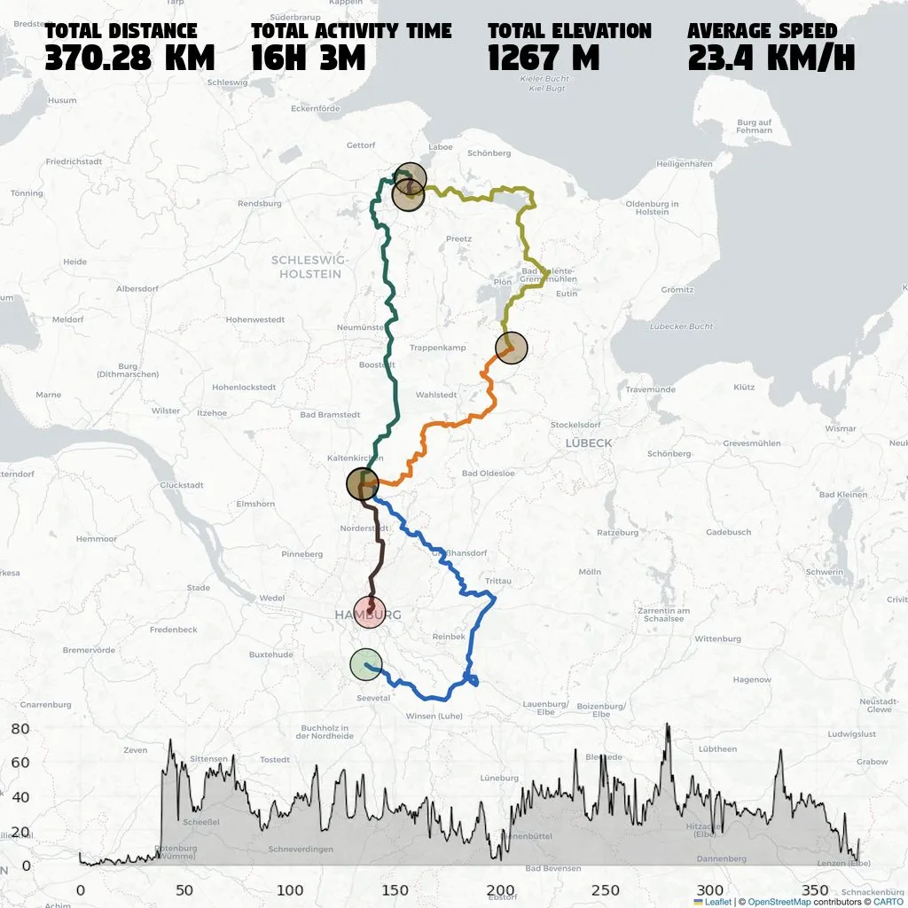
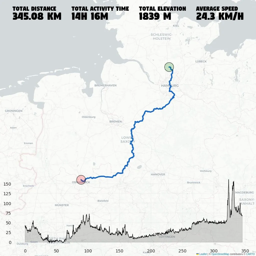
Current state
I’ll let the pictures speak for themselves.
To send cool maps and stats to my friends: quite enough ✅
To market it as a great product for a lot of money: room for improvement 😅